
Kalatungan Ridge Ultimate Race 2017
ITRA
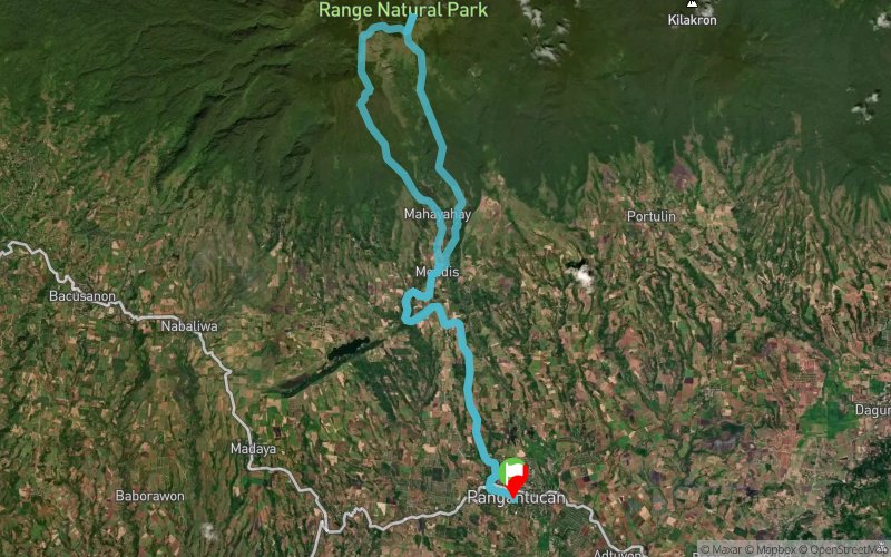
 43.2 km
2830 m
2820 m
43.2 km
2830 m
2820 m


GPX
36
PDF
Profile
Share
3D
Favorites
Reviews
Like
Kalilangan (PH) (PH)
Effort kilometer
Longest ascent
Longest descent
71
1890 m
1570 m
Max. elevation
Min. elevation
Quality index
2856 m
702 m
 1pt/7m
The 5th highest mountain in the Philippines and the coldest one.

Start
Distance
0 km
Altitude
703 m
D+
0 m
D-
0 m
43.2 km
2830 m
2820 m
Finish
Distance
43.2 km
Altitude
703 m
D+
2830 m
D-
2820 m
Click on a point of interest to display it on the map
Reviews and times
Add a track
Kalatungan Ridge Ultimate Race 2017

Track number : 27726
Link to track :
https://tracedetrail.fr/en/trace/27726
Log in to insert this track on your website
 Trace de Trail