
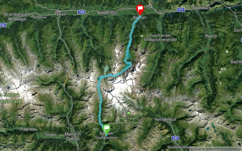
Kalser Tauern Trail 2018 - 50K
ITRA
 48.2 km
2200 m
2760 m
48.2 km
2200 m
2760 m


Like
Favorites
Reviews
Share
GPX
71
PDF A4
PDF A0
Profile
Flyover
3D
Insert
Passages
Unterburg (AT) Kaprun (AT)
Effort kilometer
Longest ascent
Longest descent
70
1230 m
2140 m
Max. elevation
Min. elevation
Quality index
2632 m
765 m
 1pt/10m
Start
Distance
0 km
Altitude
1328 m
D+
0 m
D-
0 m
48.2 km
2191 m
2753 m
Finish
Distance
48.2 km
Altitude
765 m
D+
2191 m
D-
2753 m
Click on a point of interest to display it on the map
Reviews and times
Add a track
Kalser Tauern Trail 2018 - 50K

Track number : 23931
Link to track :
https://tracedetrail.fr/en/trace/23931
Log in to insert this track on your website
 Trace de Trail