
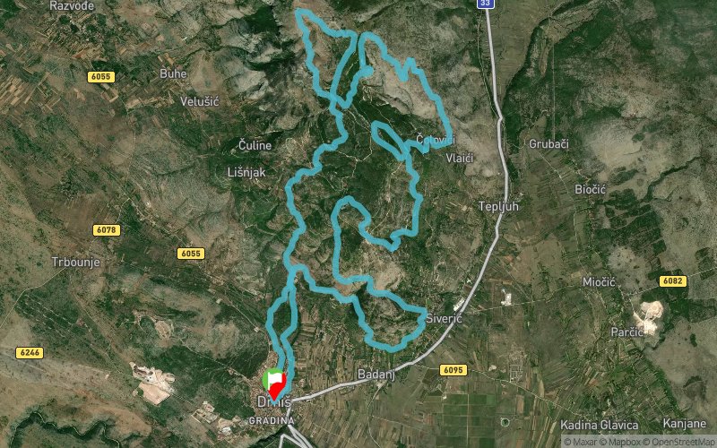
Mali Točak - 39k
ITRA
 38.8 km
2110 m
2110 m
38.8 km
2110 m
2110 m

23/03/2024
GPX
2
PDF
Profile
Share
3D
Favorites
Reviews
Like
Drniš (HR) Drniš (HR)
Effort kilometer
Longest ascent
Longest descent
59
600 m
910 m
Max. elevation
Min. elevation
Quality index
1131 m
282 m
 1pt/8m
Track created by Promina Trail Drniš
le 2023/08/01 (modified on 2023/09/19)
le 2023/08/01 (modified on 2023/09/19)

Start
Distance
0 km
Altitude
296 m
D+
0 m
D-
0 m
38.8 km
2110 m
2110 m
Finish
Distance
38.8 km
Altitude
296 m
D+
2110 m
D-
2110 m
Click on a point of interest to display it on the map
Reviews and times
Add a track
Promina Trail Drniš Mali Točak - 39k

Track number : 228171
Link to track :
https://tracedetrail.fr/en/trace/228171
Log in to insert this track on your website
 Trace de Trail