
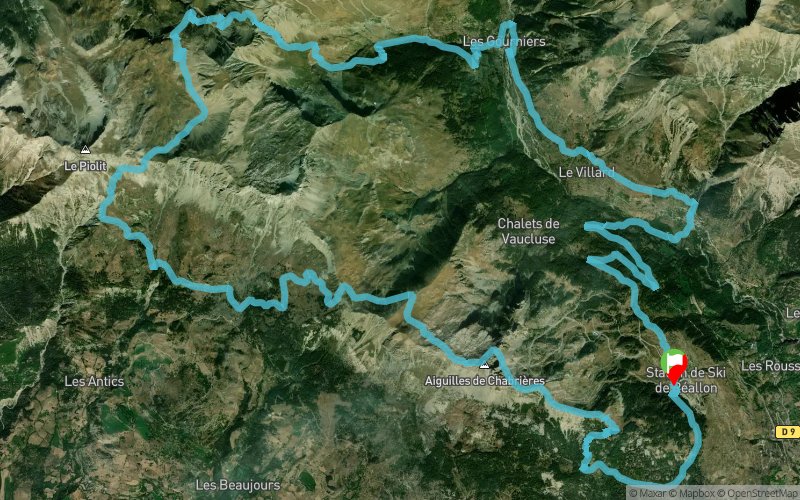
Aiguilles trail de Serre-ponçon : Marathon du lac
 37.7 km
2320 m
2320 m
37.7 km
2320 m
2320 m
11/06/2023
GPX
57
PDF
Profile
Share
3D
Favorites
Reviews
Like
Réallon (05) Réallon (05)
Effort kilometer
Longest ascent
Longest descent
60
730 m
960 m
Max. elevation
Min. elevation
Quality index
2322 m
1318 m
 1pt/30m
Start
Distance
0 km
Altitude
1547 m
D+
0 m
D-
0 m
37.7 km
2320 m
2320 m
Finish
Distance
37.7 km
Altitude
1547 m
D+
2320 m
D-
2320 m
Click on a point of interest to display it on the map
Reviews and times
Add a track
Aiguilles trail de Serre-ponçon : Marathon du lac

Track number : 219831
Link to track :
https://tracedetrail.fr/en/trace/219831
Log in to insert this track on your website
 Trace de Trail