
Escarène 18 K
ROUTE TESTED BY THE AUTHOR
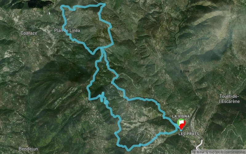
 18.4 km
1100 m
1100 m
18.4 km
1100 m
1100 m
Like
Favorites
Reviews
Share
GPX
1
PDF A4
PDF A0
Profile
Flyover
3D
Insert
Passages
L'Escarène (06) L'Escarène (06)
Effort kilometer
Longest ascent
Longest descent
29
370 m
260 m
Max. elevation
Min. elevation
Quality index
824 m
368 m
 1pt/25m
Start
Distance
0 km
Altitude
383 m
D+
0 m
D-
0 m
18.4 km
1100 m
1100 m
Finish
Distance
18.4 km
Altitude
383 m
D+
1100 m
D-
1100 m
Click on a point of interest to display it on the map
Reviews and times
Add a track
Escarène 18 K

Track number : 218157
Link to track :
https://tracedetrail.fr/en/trace/218157
Log in to insert this track on your website
 Trace de Trail