
DELICIOUS TRAIL DOLOMITI 2023-SHORT
ITRA
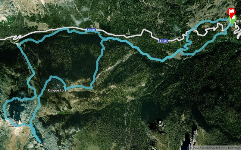
 22.3 km
1240 m
1230 m
22.3 km
1240 m
1230 m

30/09/2023
GPX
16
PDF
Profile
Share
3D
Favorites
Reviews
Like
Cortina D'Ampezzo (IT) Cortina D'Ampezzo (IT)
Effort kilometer
Longest ascent
Longest descent
34
1050 m
950 m
Max. elevation
Min. elevation
Quality index
2486 m
1502 m
 1pt/19m
Start
Distance
0 km
Altitude
1527 m
D+
0 m
D-
0 m
22.3 km
1232 m
1230 m
Finish
Distance
22.3 km
Altitude
1527 m
D+
1232 m
D-
1230 m
Click on a point of interest to display it on the map
Reviews and times
Add a track
DELICIOUS TRAIL DOLOMITI 2023-SHORT

Track number : 216661
Link to track :
https://tracedetrail.fr/en/trace/216661
Log in to insert this track on your website
 Trace de Trail