
DELICIOUS TRAIL DOLOMITI 2023-TRAIL
ITRA
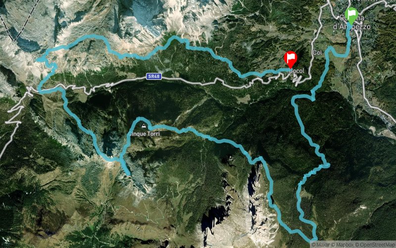
 42.5 km
3060 m
2740 m
42.5 km
3060 m
2740 m

30/09/2023
Like
6 Favorites
Reviews
Share
GPX
280
PDF A4
PDF A0
Profile
Flyover
3D
Insert
Passages
Cortina d'Ampezzo (IT) Pocol (IT)
Effort kilometer
Longest ascent
Longest descent
73
900 m
1340 m
Max. elevation
Min. elevation
Quality index
2733 m
1148 m
 1pt/23m
Start
Distance
0 km
Altitude
1218 m
D+
0 m
D-
0 m
42.5 km
3051 m
2735 m
Finish
Distance
42.5 km
Altitude
1536 m
D+
3051 m
D-
2735 m
Click on a point of interest to display it on the map
Reviews and times
Add a track
DELICIOUS TRAIL DOLOMITI 2023-TRAIL

Track number : 216660
Link to track :
https://tracedetrail.fr/en/trace/216660
Log in to insert this track on your website
 Trace de Trail