
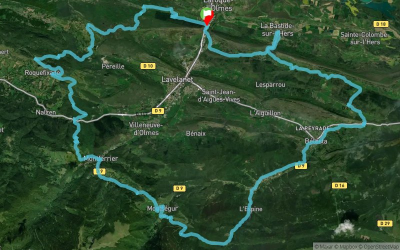
GR tour des monts d'olmes
ROUTE TESTED BY THE AUTHOR
 67.4 km
2570 m
2570 m
67.4 km
2570 m
2570 m
GPX
PDF
Profile
Share
3D
Favorites
Reviews
1 Like
Dreuilhe (09) Dreuilhe (09)
Effort kilometer
Longest ascent
Longest descent
93
540 m
700 m
Max. elevation
Min. elevation
Quality index
1060 m
429 m
 1pt/65m
A très peu de choses près, c'est le GR Tour des mont d'olmes

Start
Distance
0 km
Altitude
465 m
D+
0 m
D-
0 m
67.4 km
2570 m
2570 m
Finish
Distance
67.4 km
Altitude
465 m
D+
2570 m
D-
2570 m
Click on a point of interest to display it on the map
Reviews and times
jahzus2023/04/02
2023/04/01 07:50:00
2023/04/01 07:50:00
Tracé très sympa jusqu'au km 39, avec plusieurs tronçons en commun avec le trail des citadelles.
Au delà du km 39, nombreux tronçons gourdronnés, balisage quasi absent du km 48 au km 63 avec un chemin presque effacé (km51)/
Clairement, le retour Fourgax--> Laroque d'olmes est à revoir.
Add a track
GR tour des monts d'olmes

Track number : 214832
Link to track :
https://tracedetrail.fr/en/trace/214832
Log in to insert this track on your website
 Trace de Trail