
64K
ITRA
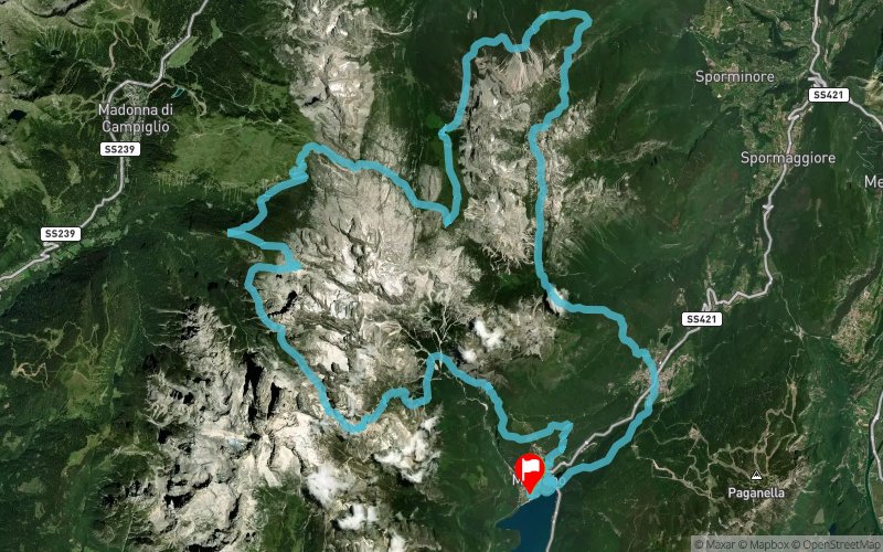
 64.6 km
3930 m
3920 m
64.6 km
3930 m
3920 m

09/09/2023
GPX
134
PDF
Profile
Share
3D
Favorites
Reviews
Like
Molveno (IT) Molveno (IT)
Effort kilometer
Longest ascent
Longest descent
103
1350 m
1790 m
Max. elevation
Min. elevation
Quality index
2541 m
832 m
 1pt/10m
Start
Distance
0 km
Altitude
833 m
D+
0 m
D-
0 m
64.6 km
3921 m
3911 m
Finish
Distance
64.6 km
Altitude
842 m
D+
3921 m
D-
3911 m
Click on a point of interest to display it on the map
Reviews and times
Add a track
Dolomiti di Brenta Trail 64K

Track number : 209219
Link to track :
https://tracedetrail.fr/en/trace/209219
Log in to insert this track on your website
 Trace de Trail