
Ohm Trail Ultra
ITRA
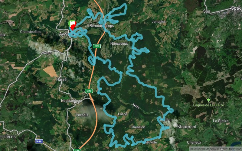
 80 km
3830 m
3830 m
80 km
3830 m
3830 m

04/06/2023
GPX
30
PDF
Profile
Share
3D
Favorites
Reviews
Like
Aywaille (BE) Aywaille (BE)
Effort kilometer
Longest ascent
Longest descent
118
350 m
320 m
Max. elevation
Min. elevation
Quality index
504 m
113 m
 1pt/10m
Start
Distance
0 km
Altitude
116 m
D+
0 m
D-
0 m
80 km
3830 m
3830 m
Finish
Distance
80 km
Altitude
116 m
D+
3830 m
D-
3830 m
Click on a point of interest to display it on the map
Reviews and times
Add a track
Ohm Trail Ohm Trail Ultra

Track number : 206007
Link to track :
https://tracedetrail.fr/en/trace/206007
Log in to insert this track on your website
 Trace de Trail