
CHALMA'VERTICAL
ITRA
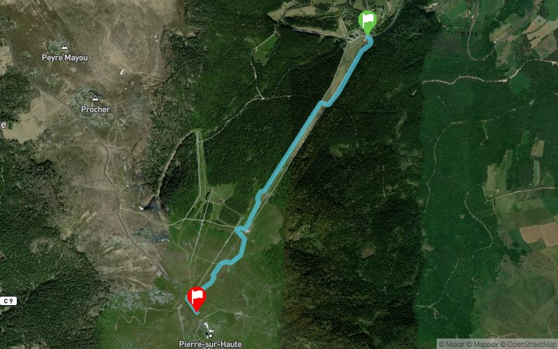
 3.4 km
500 m
0 m
3.4 km
500 m
0 m

01/07/2023
GPX
14
PDF
Profile
Share
3D
Favorites
Reviews
Like
Chalmazel-Jeansagniere (FR) Chalmazel-Jeansagniere (FR)
Effort kilometer
Longest ascent
Longest descent
8
500 m
0 m
Max. elevation
Min. elevation
Quality index
1609 m
1109 m
 1pt/51m
Start
Distance
0 km
Altitude
1109 m
D+
0 m
D-
0 m
3.4 km
500 m
0 m
Finish
Distance
3.4 km
Altitude
1609 m
D+
500 m
D-
0 m
Click on a point of interest to display it on the map
Reviews and times
Add a track
CHALMATRAIL CHALMA'VERTICAL

Track number : 203890
Link to track :
https://tracedetrail.fr/en/trace/203890
Log in to insert this track on your website
 Trace de Trail