
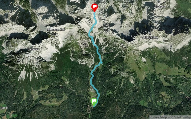
Kaiserkrone_Vertikal
 4.83 km
1036 m
0 m
4.83 km
1036 m
0 m
23/06/2023
GPX
29
PDF
Profile
Share
3D
Favorites
Reviews
Like
Going am Wilden Kaiser (AT) Prama (AT)
Effort kilometer
Longest ascent
Longest descent
15
1040 m
0 m
Max. elevation
Min. elevation
Quality index
1978 m
942 m
 1pt/17m
Start
Distance
0 km
Altitude
942 m
D+
0 m
D-
0 m
4.8 km
1036 m
0 m
Finish
Distance
4.8 km
Altitude
1978 m
D+
1036 m
D-
0 m
Click on a point of interest to display it on the map
Reviews and times
Add a track
Kaiserkrone_Vertikal

Track number : 202090
Link to track :
https://tracedetrail.fr/en/trace/202090
Log in to insert this track on your website
 Trace de Trail