
La 6000D 2023 - Relais à 3 - Relais 2
ITRA
 26.8 km
1690 m
1750 m
26.8 km
1690 m
1750 m


GPX
18
PDF
Profile
Share
3D
Favorites
Reviews
Like
Mâcot-la-Plagne (73) Mâcot-la-Plagne (73)
Effort kilometer
Longest ascent
Longest descent
43
760 m
1080 m
Max. elevation
Min. elevation
Quality index
3064 m
1922 m
 1pt/10m


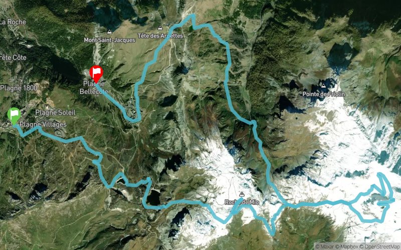
Aime-la-Plagne
Distance
0 km
Altitude
1981 m
D+
0 m
D-
0 m
7.8 km
757 m
46 m
Roche de Mio
Distance
7.8 km
Altitude
2693 m
D+
757 m
D-
46 m
2.6 km
4 m
205 m
Col de la Chiaupe
Distance
10.5 km
Altitude
2491 m
D+
761 m
D-
251 m
2.4 km
501 m
0 m
Glacier de Bellecôte
Distance
12.9 km
Altitude
2993 m
D+
1262 m
D-
251 m
4.5 km
78 m
577 m
Col de la Chiaupe
Distance
17.4 km
Altitude
2491 m
D+
1340 m
D-
828 m
1 km
0 m
210 m
Telésiège Chalet de Bellecôte
Distance
18.5 km
Altitude
2283 m
D+
1340 m
D-
1038 m
3.1 km
56 m
294 m
Chalet du Carroley
Distance
21.6 km
Altitude
2045 m
D+
1396 m
D-
1332 m
1.7 km
288 m
0 m
Col de l'Arpette
Distance
23.4 km
Altitude
2333 m
D+
1684 m
D-
1332 m
3.3 km
6 m
417 m
Finish
Distance
26.8 km
Altitude
1922 m
D+
1690 m
D-
1749 m
Click on a point of interest to display it on the map
Reviews and times
Add a track
La 6000D 2023 - Relais à 3 - Relais 2

Track number : 197731
Link to track :
https://tracedetrail.fr/en/trace/197731
Log in to insert this track on your website
 Trace de Trail