
The North Face Lavaredo Ultra Trail 2016 - Cortina Skyrace
ITRA
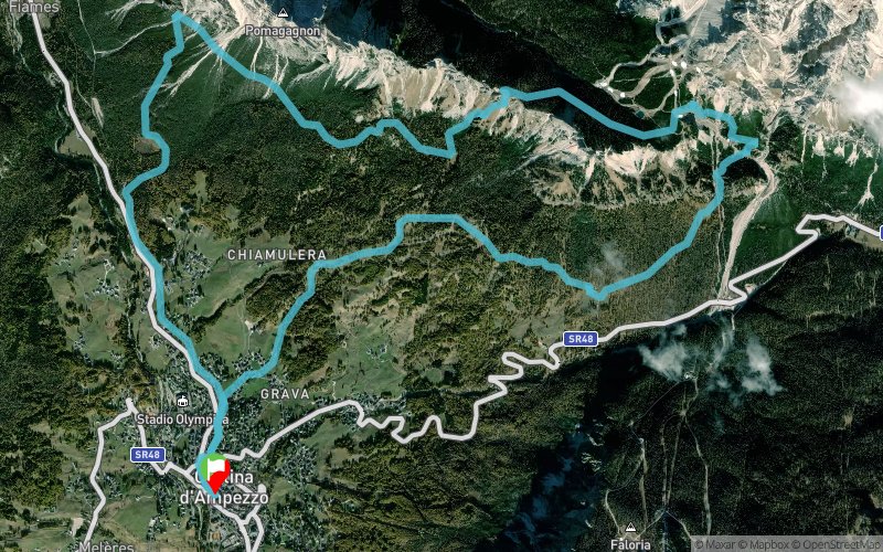
 19.6 km
1080 m
1080 m
19.6 km
1080 m
1080 m

GPX
62
PDF
Profile
Share
3D
Favorites
Reviews
Like
Cortina D'Ampezzo (IT) (IT)
Effort kilometer
Longest ascent
Longest descent
30
440 m
510 m
Max. elevation
Min. elevation
Quality index
2042 m
1164 m
 1pt/8m
Venti chilometri e mille metri di dislivello positivo per questa skyrace che parte e arriva dal centro di Cortina e porta a scoprire dall’alto tutta la conca ampezzana. Forcella Zumeles, il punto più alto del percorso, va conquistata salendo faticosamente ripidi pendii erbosi e rocciosi, ma regala un panorama fantastico sulla Regina delle Dolomiti e sulle montagne che la circondano: Cristallo, Tofane, Cinque Torri, fino a Pelmo, Civetta e Marmolada.
En voir plus... En voir moins...

Start
Distance
0 km
Altitude
1216 m
D+
0 m
D-
0 m
19.6 km
1080 m
1080 m
Finish
Distance
19.6 km
Altitude
1216 m
D+
1080 m
D-
1080 m
Click on a point of interest to display it on the map
Reviews and times
Add a track
The North Face Lavaredo Ultra Trail 2016 - Cortina Skyrace

Track number : 19598
Link to track :
https://tracedetrail.fr/en/trace/19598
Log in to insert this track on your website
 Trace de Trail