
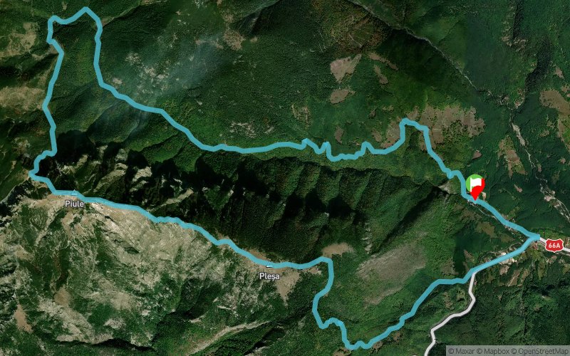
Retezat SkyRace 2022 - Traseul Buta
 22 km
1580 m
1580 m
22 km
1580 m
1580 m
18/06/2022
GPX
51
PDF
Profile
Share
3D
Favorites
Reviews
Like
Câmpu lui Neag (RO) Câmpu lui Neag (RO)
Effort kilometer
Longest ascent
Longest descent
37
1350 m
1420 m
Max. elevation
Min. elevation
Quality index
2080 m
860 m
 1pt/19m
Start
Distance
0 km
Altitude
882 m
D+
0 m
D-
0 m
22 km
1580 m
1580 m
Finish
Distance
22 km
Altitude
882 m
D+
1580 m
D-
1580 m
Click on a point of interest to display it on the map
Reviews and times
Add a track
Retezat SkyRace 2022 - Traseul Buta

Track number : 184921
Link to track :
https://tracedetrail.fr/en/trace/184921
Log in to insert this track on your website
 Trace de Trail