
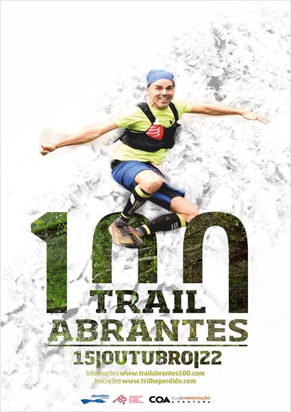
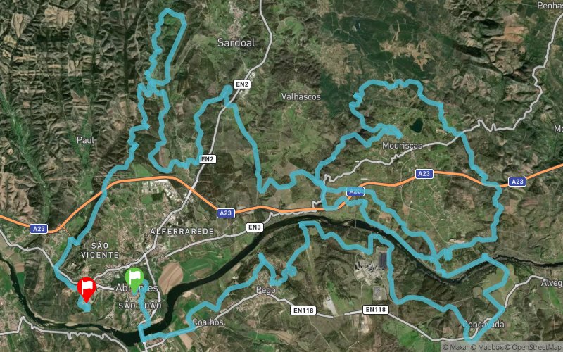
Trail Abrantes 100 2022 - 100km
ITRA
 103.1 km
2710 m
2750 m
103.1 km
2710 m
2750 m

GPX
126
PDF
Profile
Share
3D
Favorites
Reviews
Like
Praça Barão da Batalha - Abrantes (PT) Cidade Desportiva - Abrantes (PT)
Effort kilometer
Longest ascent
Longest descent
130
150 m
160 m
Max. elevation
Min. elevation
Quality index
243 m
20 m
 1pt/15m

Praça Barão da Batalha - Abrantes
Distance
0 km
Altitude
164 m
D+
0 m
D-
0 m
11 km
198 m
273 m
PAC 1 - JF Pego
Distance
11 km
Altitude
91 m
D+
198 m
D-
273 m
6.5 km
164 m
157 m
PAC 2 - Central Pego (Casas Brancas)
Distance
17.6 km
Altitude
96 m
D+
362 m
D-
430 m
7.6 km
181 m
164 m
PAC 3 / ZT 1 - Concavada (Associação)
Distance
25.2 km
Altitude
113 m
D+
543 m
D-
594 m
9.9 km
183 m
204 m
PAC 4 - Varandas
Distance
35.2 km
Altitude
92 m
D+
726 m
D-
798 m
7.9 km
268 m
167 m
PAC 5 - Filarmónica
Distance
43.1 km
Altitude
192 m
D+
994 m
D-
965 m
8.5 km
245 m
283 m
PAC 6 / ZT 2 - Mouriscas (EPDRA)
Distance
51.7 km
Altitude
155 m
D+
1239 m
D-
1248 m
7.8 km
150 m
234 m
PAC 7 - Mouriscas (Oliveira Milenar)
Distance
59.5 km
Altitude
71 m
D+
1389 m
D-
1482 m
6.1 km
133 m
142 m
PAC 8 - Casal das Mansas
Distance
65.7 km
Altitude
62 m
D+
1522 m
D-
1624 m
11.6 km
296 m
262 m
PAC 9 / ZT 3 - Casais de Revelhos
Distance
77.3 km
Altitude
95 m
D+
1818 m
D-
1886 m
5.4 km
176 m
133 m
PAC 10 - Sentieiras (Campo de futebol)
Distance
82.8 km
Altitude
140 m
D+
1994 m
D-
2019 m
7.4 km
330 m
318 m
PAC 11 - Sentieiras (Campo de futebol)
Distance
90.2 km
Altitude
152 m
D+
2324 m
D-
2337 m
12.8 km
384 m
406 m
PAC 12 - Meta
Distance
103.1 km
Altitude
129 m
D+
2708 m
D-
2743 m
Click on a point of interest to display it on the map
Reviews and times
Add a track
Trail Abrantes 100 2022 - 100km

Track number : 181633
Link to track :
https://tracedetrail.fr/en/trace/181633
Log in to insert this track on your website
 Trace de Trail