
Circuit 41. Le lac du Lurien
SELECTED ROUTE
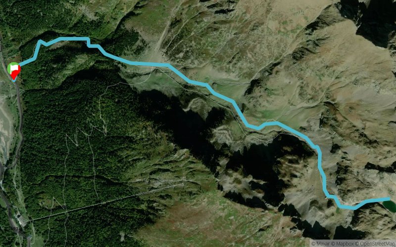
 7.7 km
960 m
960 m
7.7 km
960 m
960 m
GPX
5
PDF
Profile
Share
3D
Favorites
Reviews
Like
Fabrèges (ES) Formigal (ES)
Effort kilometer
Longest ascent
Longest descent
17
960 m
960 m
Max. elevation
Min. elevation
Quality index
2214 m
1254 m
 1pt/6m
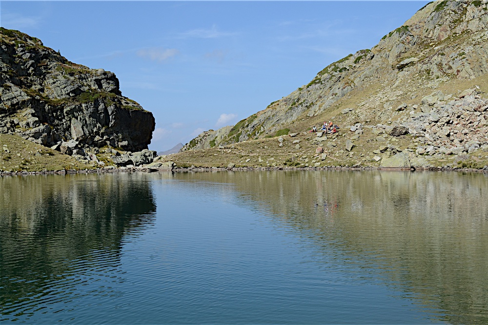
Le vallon du Lurien et son lac font partie des rares endroits privilégiés qui ont su garder le caractère sauvage des montagnes d’Ossau. Le sentier un peu raide dans la forêt dissuade les promeneurs et laisse cette montagne aux randonneurs. C’est donc au pas du montagnard qu’il faut remonter ce vallon qui devient de plus en plus étroit et sinueux au fur et à mesure de la progression.
En voir plus... En voir moins...

Fabrèges
Distance
0 km
Altitude
1254 m
D+
0 m
D-
0 m
7.7 km
960 m
960 m
Finish
Distance
7.7 km
Altitude
1254 m
D+
960 m
D-
960 m
Click on a point of interest to display it on the map
Reviews and times
Add a track
Circuit 41. Le lac du Lurien

Track number : 179516
Link to track :
https://tracedetrail.fr/en/trace/179516
Log in to insert this track on your website
 Trace de Trail