
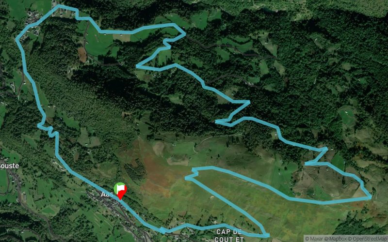
Circuit 26. La montagne verte
SELECTED ROUTE
 10.5 km
560 m
560 m
10.5 km
560 m
560 m
GPX
23
PDF
Profile
Share
3D
Favorites
Reviews
4 Like
Aas (64) Eaux-Bonnes (64)
Effort kilometer
Longest ascent
Longest descent
16
430 m
550 m
Max. elevation
Min. elevation
Quality index
1191 m
635 m
 1pt/11m
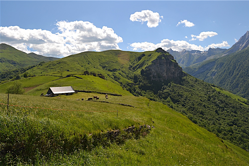
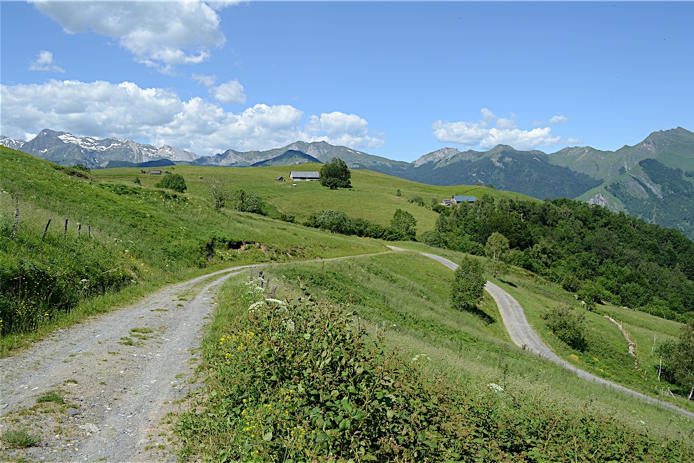
Elle porte bien son nom la montagne verte, ses pâturages restent verts même en été. Il faut dire que l’eau y est abondante et nombre de sources jaillissent de ses flancs. Son quartier de granges au sommet et les formes douces de sa crête contrastent avec la rigueur des montagnes voisines. Ce belvédère naturel offre un panorama sur la vallée des Eaux-Bonnes et le pic du Ger spectaculaire et aérien.
En voir plus... En voir moins...

Aas
Distance
0 km
Altitude
773 m
D+
0 m
D-
0 m
10.5 km
560 m
560 m
Finish
Distance
10.5 km
Altitude
773 m
D+
560 m
D-
560 m
Click on a point of interest to display it on the map
Reviews and times
Lucy-Lang2024/05/25
2024/05/25 03:00:00
2024/05/25 03:00:00
Terrain un peu boueux par moment attention au temps des jours précédents
Alex20012023/08/23
Magnifique ! A faire absolument !
La première partie est magnifique, vous marchez sur un sentier entouré de fleur, faut pas avoir le vertige (attention !!) ! Il y a beaucoup de papillons et d’insectes ! Quand vous passez de l’autre côté, c’est moins dingue, ça reste sympa mais vous êtes sur du goudron et dans les arbres. Les paysages n’en reste pas moins impressionnants ! Et puis c’est excellent, il y a plein de lavoirs ou des petites fontaines, où on peut tremper sa casquette par 31°C. L’eau est non portable pour se protéger juridiquement, mais un des gars du village nous a dit que c’était ok ! Alors faites vous plaisir !
Passez une bonne journée ! Et bonne rando !
Aurelien00332022/08/22
Je n’ai fait que la montée de la montagne qui surplombe le village Eaux Bonnes et c’était magnifique! Sentier propre et bien balisé. La crête est superbe : beau pont de vue, végétation, éperviers et autres rapaces… j’aurais bien continué! Montée rude sur 250 m de dénivelé environ puis plus tranquille.
Add a track
Circuit 26. La montagne verte

Track number : 178928
Link to track :
https://tracedetrail.fr/en/trace/178928
Log in to insert this track on your website
 Trace de Trail