
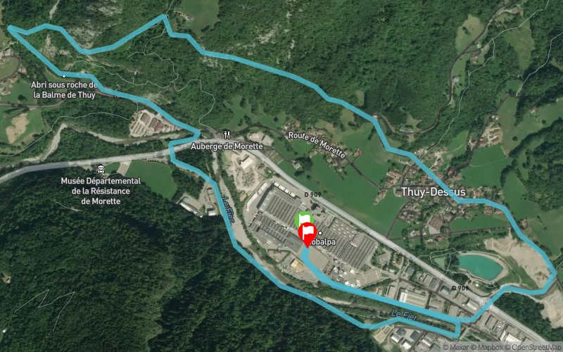
La Balme de Thuy - Nant Debout - Thuy Dessus
ROUTE TESTED BY THE AUTHOR
 7 km
190 m
190 m
7 km
190 m
190 m
GPX
PDF
Profile
Share
3D
Favorites
Reviews
3 Like
La Balme-de-Thuy (74) La Balme-de-Thuy (74)
Effort kilometer
Longest ascent
Longest descent
8
180 m
10 m
Max. elevation
Min. elevation
Quality index
764 m
578 m
 1pt/16m
Finish
Distance
0 km
Altitude
589 m
D+
199 m
D-
193 m
0 km
0 m
0 m
Start
Distance
0 km
Altitude
586 m
D+
0 m
D-
0 m
Click on a point of interest to display it on the map
Reviews and times
RichardCh2023/04/12
2023/04/12 00:44:24
2023/04/12 00:44:24
RichardCh2023/03/31
2023/03/31 00:48:11
2023/03/31 00:48:11
RichardCh2022/04/05
2022/04/05 00:47:31
2022/04/05 00:47:31
Add a track
La Balme de Thuy - Nant Debout - Thuy Dessus

Track number : 178195
Link to track :
https://tracedetrail.fr/en/trace/178195
Log in to insert this track on your website
 Trace de Trail