
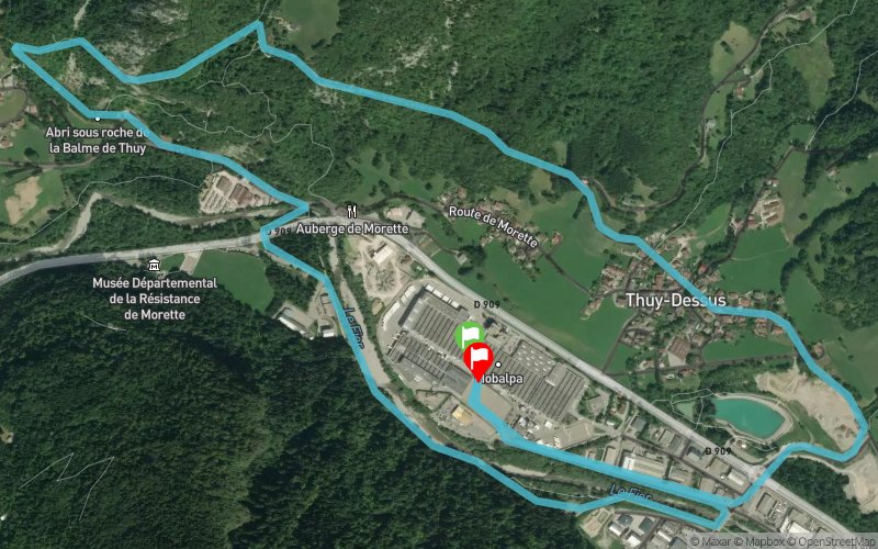
Pont de Morette - Cascade de Morette - Thuy dessus
ROUTE TESTED BY THE AUTHOR
 7 km
200 m
200 m
7 km
200 m
200 m
GPX
PDF
Profile
Share
3D
Favorites
Reviews
3 Like
La Balme-de-Thuy (74) La Balme-de-Thuy (74)
Effort kilometer
Longest ascent
Longest descent
9
180 m
10 m
Max. elevation
Min. elevation
Quality index
764 m
577 m
 1pt/16m
Finish
Distance
0 km
Altitude
589 m
D+
202 m
D-
200 m
0 km
0 m
0 m
Start
Distance
0 km
Altitude
586 m
D+
0 m
D-
0 m
Click on a point of interest to display it on the map
Reviews and times
RichardCh2023/03/22
2023/03/22 00:49:28
2023/03/22 00:49:28
RichardCh2022/05/13
2022/05/13 00:51:23
2022/05/13 00:51:23
RichardCh2022/03/31
2022/03/31 00:46:59
2022/03/31 00:46:59
Add a track
Pont de Morette - Cascade de Morette - Thuy dessus

Track number : 177787
Link to track :
https://tracedetrail.fr/en/trace/177787
Log in to insert this track on your website
 Trace de Trail