
Trail de la Valserine 2022 - 54 km 1-4
ITRA
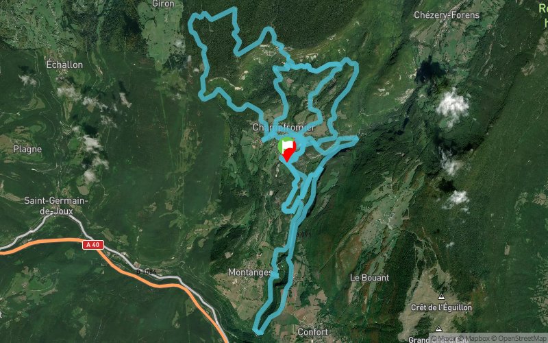
 53.7 km
2350 m
2350 m
53.7 km
2350 m
2350 m

04/06/2022
GPX
5
PDF
Profile
Share
3D
Favorites
Reviews
Like
Champfromier (01) Champfromier (01)
Effort kilometer
Longest ascent
Longest descent
77
640 m
360 m
Max. elevation
Min. elevation
Quality index
1199 m
370 m
 1pt/7m
Track created by club athletique du bassin bellegardien
le 2021/12/26 (modified on 2022/06/03)
le 2021/12/26 (modified on 2022/06/03)

Start
Distance
0 km
Altitude
677 m
D+
0 m
D-
0 m
53.7 km
2350 m
2350 m
Finish
Distance
53.7 km
Altitude
677 m
D+
2350 m
D-
2350 m
Click on a point of interest to display it on the map
Reviews and times
Add a track
Trail de la Valserine 2022 - 54 km 1-4

Track number : 168993
Link to track :
https://tracedetrail.fr/en/trace/168993
Log in to insert this track on your website
 Trace de Trail