
Trekyllisheidin Ultra Trail Run - 48 km
ITRA
 48.4 km
1150 m
1140 m
48.4 km
1150 m
1140 m

13/08/2022
GPX
10
PDF
Profile
Share
3D
Favorites
Reviews
Like
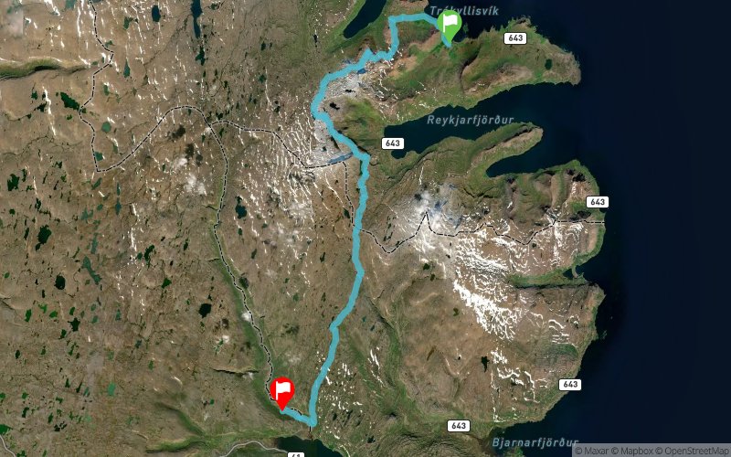
Trekyllisvik (IS) Selardalur valley (IS)
Effort kilometer
Longest ascent
Longest descent
59
610 m
390 m
Max. elevation
Min. elevation
Quality index
517 m
24 m
 1pt/11m
Start
Distance
0 km
Altitude
31 m
D+
0 m
D-
0 m
48.4 km
1145 m
1140 m
Finish
Distance
48.4 km
Altitude
37 m
D+
1145 m
D-
1140 m
Click on a point of interest to display it on the map
Reviews and times
Add a track
Trekyllisheidin Ultra Trail Run - 48 km

Track number : 167645
Link to track :
https://tracedetrail.fr/en/trace/167645
Log in to insert this track on your website
 Trace de Trail