
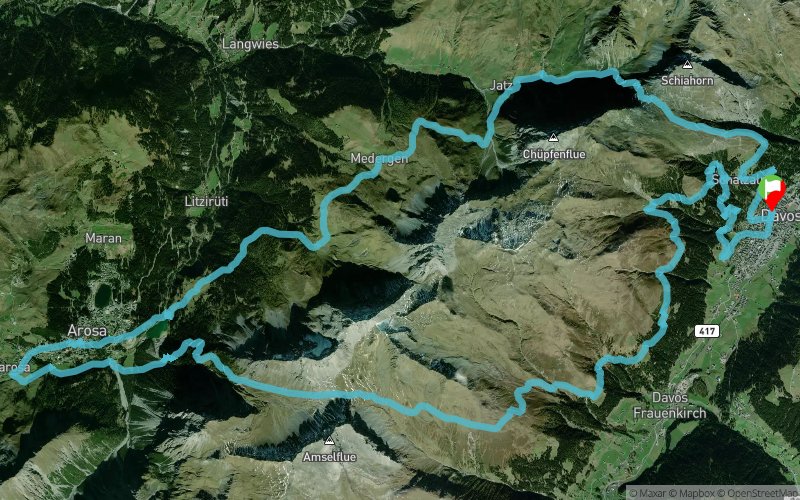
Swiss Irontrail 2015 - T41
ITRA
 44 km
2490 m
2500 m
44 km
2490 m
2500 m


GPX
4
PDF
Profile
Share
3D
Favorites
Reviews
Like
Davos Platz (CH) (CH)
Effort kilometer
Longest ascent
Longest descent
68
630 m
830 m
Max. elevation
Min. elevation
Quality index
2438 m
1561 m
 1pt/46m
With its exceptional experiences of nature and diversified routes, the Swiss Iron Trail is renowned worldwide as the most beautiful ultratrail.
Ultrarunners, the ambitious, hikers seeking experience and enjoyment, and families alike, will be tempted by the many different routes offered. From the supreme discipline event, with its 200 km, and almost 11500-metre altitude difference, over diversified trails, to the marathon distance event, and experience-filled hiking trails – there is something for everyone who has been bitten by the trail sport bug.
En voir plus... En voir moins...

Start
Distance
0 km
Altitude
1564 m
D+
0 m
D-
0 m
44 km
2490 m
2500 m
Finish
Distance
44 km
Altitude
1564 m
D+
2490 m
D-
2500 m
Click on a point of interest to display it on the map
Reviews and times
Add a track
Swiss Irontrail 2015 - T41

Track number : 16130
Link to track :
https://tracedetrail.fr/en/trace/16130
Log in to insert this track on your website
 Trace de Trail