Show the map
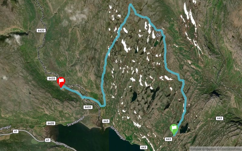
Trekyllisheidin Mini Trail Run - 17 km
Trekyllisheidin mini (16.5K) is the short version of Trekyllisheidin, providing runners with an excellent opportunity to enter the ultra running community and get some ITRA-points, even the first ones. The race starts on the mountain pass Bjarnarfjarðarháls, between Steingrímsfjörður and Bjarnarfjörður, north of the scenic fishing village Hólmavík. The route follows a rough and at some times a bit muddy super-jeep trail into Trekyllisheidi. After 8.5 km it is about time to turn left and follow the same path as the ultra runners participating in Trekyllisheidin ultra, down to Selárdalur walley, across river Selá and towards the goal at the ski hut at Brandsholt. From there it is only 16 km drive (or run) to the swimming pool and hot pots in Hólmavík – or 21 km towards east to the fishing village of Drangsnes.
Points of Interest table
Accum. | Intermediary | |||||||
---|---|---|---|---|---|---|---|---|
POI | Description | Alt. | Dist. | D+ | D- | Dist. | D+ | D- |

Trace n°156349
Ascent threshold : 3 m Distance threshold : 30 m Smoothing : No Origin of altitudes :
Crossing
Dominant terrain : Path
Max alti. : 348 m
Avg alti. : 207 m
Min alti. : 3 m
Longest ascent : 290 m
Longest descent : 340 m
Dominant terrain : Path
Max alti. : 348 m
Avg alti. : 207 m
Min alti. : 3 m
Longest ascent : 290 m
Longest descent : 340 m
Elevation profile

More tools
Create a new roadbook page
Map and track on your website
Warning ! When you insert a Trace de Trail map on your website, you agree not to hide any element of the module (links to Trail Trail or Trail Connect banner)
Add a realisation
Validate
Add a realisation to share your chrono and describe the conditions that you encountered during you trail running !
Add a comment
Validate
Show the infos
Add a track