
Ultramarathon Górski 2021 - Ultra
ITRA
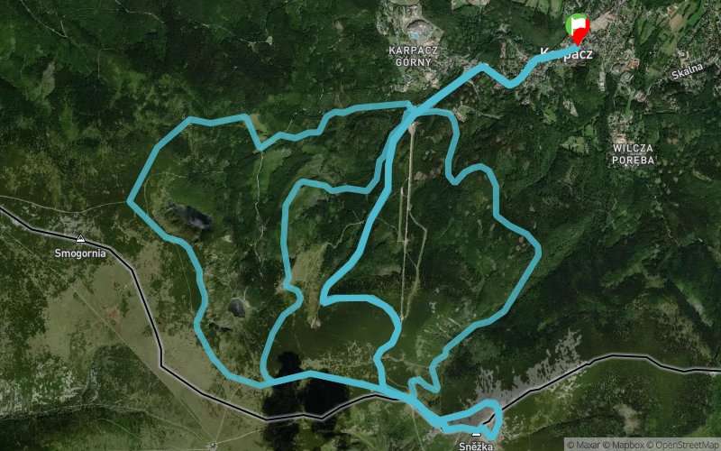
 58.6 km
3250 m
3250 m
58.6 km
3250 m
3250 m

GPX
88
PDF
Profile
Share
3D
Favorites
Reviews
Like
Karpacz (PL) Karpacz (PL)
Effort kilometer
Longest ascent
Longest descent
91
1120 m
1040 m
Max. elevation
Min. elevation
Quality index
1607 m
600 m
 1pt/14m
Start
Distance
0 km
Altitude
620 m
D+
0 m
D-
0 m
58.6 km
3250 m
3250 m
Finish
Distance
58.6 km
Altitude
620 m
D+
3250 m
D-
3250 m
Click on a point of interest to display it on the map
Reviews and times
Add a track
Ultramarathon Górski 2021 - Ultra

Track number : 149775
Link to track :
https://tracedetrail.fr/en/trace/149775
Log in to insert this track on your website
 Trace de Trail