
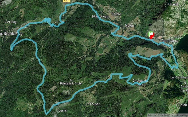
Parcours 39 - Abondance
SELECTED ROUTE
 25.1 km
900 m
900 m
25.1 km
900 m
900 m

GPX
136
PDF
Profile
Share
3D
Favorites
Reviews
1 Like
Abondance (74) Abondance (74)
Effort kilometer
Longest ascent
Longest descent
34
890 m
760 m
Max. elevation
Min. elevation
Quality index
1671 m
883 m
 1pt/15m
Nouveau parcours à Abondance
Track created by Portes du Soleil Summer
le 2021/03/31 (modified on 2021/07/22)
le 2021/03/31 (modified on 2021/07/22)

Start
Distance
0 km
Altitude
911 m
D+
0 m
D-
0 m
25.1 km
900 m
900 m
Finish
Distance
25.1 km
Altitude
911 m
D+
900 m
D-
900 m
Click on a point of interest to display it on the map
Reviews and times
Beelands2023/07/27
Followed the route starting at Abondance, the climb starts at Bonnevaux and up to Col du Corbier where the off road starts, the climb continues. At about the +550 meter point there is a great view of Mont Blanc. At this point I had used 50% of my 500w battery. Shortly after the back side of the Abondance ski area comes into view. From the base of the lift you follow a steep rough path up at the same gradient as the ski slope, steep and rough, I had to use the walk mode which is a rare occurrence for me. The last part is rideable and takes you to the very top of the ski area. It all down from there. Route was well marked and I use 60% of 500W. Will try it the other way next time.
Add a track
Parcours 39 - Abondance

Track number : 144573
Link to track :
https://tracedetrail.fr/en/trace/144573
Log in to insert this track on your website
 Trace de Trail