
Denis Rankin Round 2014
ITRA
 89.1 km
6080 m
6080 m
89.1 km
6080 m
6080 m

GPX
10
PDF
Profile
Share
3D
Favorites
Reviews
Like
Newcastle (GB) (GB)
Effort kilometer
Longest ascent
Longest descent
149
850 m
760 m
Max. elevation
Min. elevation
Quality index
864 m
8 m
 1pt/10m
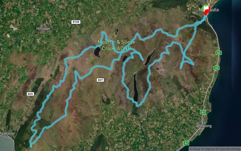
The Denis Rankin Round is a mountain challenge which connects all the 400 metre plus summits in the Mourne Mountains, County Down , Northern Ireland.

Start
Distance
0 km
Altitude
8 m
D+
0 m
D-
0 m
89.1 km
6080 m
6080 m
Finish
Distance
89.1 km
Altitude
8 m
D+
6080 m
D-
6080 m
Click on a point of interest to display it on the map
Reviews and times
Add a track
Denis Rankin Round 2014

Track number : 13815
Link to track :
https://tracedetrail.fr/en/trace/13815
Log in to insert this track on your website
 Trace de Trail