
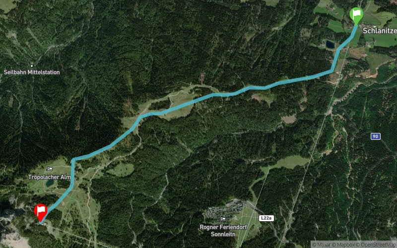
Vertical Test Tröpollach - Tröpollacher Alm
 5 km
1030 m
60 m
5 km
1030 m
60 m
24/09/2021
GPX
7
PDF
Profile
Share
3D
Favorites
Reviews
Like
Schlanitzen (AT) Sonnenalpe Nassfeld (AT)
Effort kilometer
Longest ascent
Longest descent
15
1030 m
50 m
Max. elevation
Min. elevation
Quality index
1807 m
831 m
 1pt/12m
Start
Distance
0 km
Altitude
831 m
D+
0 m
D-
0 m
5 km
1028 m
52 m
Finish
Distance
5 km
Altitude
1807 m
D+
1028 m
D-
52 m
Click on a point of interest to display it on the map
Reviews and times
Add a track
Vertical Test Tröpollach - Tröpollacher Alm

Track number : 130878
Link to track :
https://tracedetrail.fr/en/trace/130878
Log in to insert this track on your website
 Trace de Trail