
Club Manikou - Octobre 2013 - RD1 Saint Joseph
 13.6 km
497 m
896 m
13.6 km
497 m
896 m

GPX
137
PDF
Profile
Share
3D
Favorites
Reviews
Like
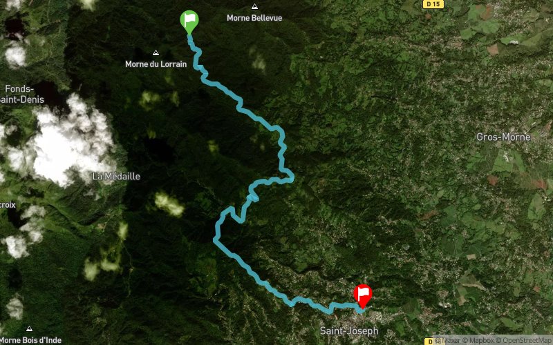
Gros Morne RD1 (MQ) Saint-Joseph Hall des Sports (MQ)
Effort kilometer
Longest ascent
Longest descent
18
265 m
373 m
Max. elevation
Min. elevation
Quality index
632 m
226 m
 1pt/30m
Start
Distance
0 km
Altitude
632 m
D+
0 m
D-
0 m
13.6 km
497 m
896 m
Finish
Distance
13.6 km
Altitude
231 m
D+
497 m
D-
896 m
Click on a point of interest to display it on the map
Reviews and times
Add a track
Club Manikou - Octobre 2013 - RD1 Saint Joseph

Track number : 1231
Link to track :
https://tracedetrail.fr/en/trace/1231
Log in to insert this track on your website
 Trace de Trail