
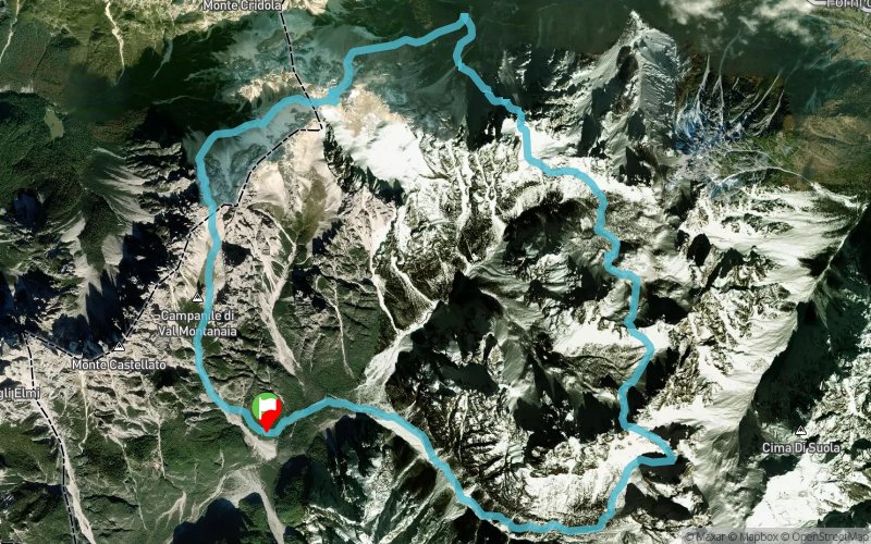
Rifugio Pordenone - Campanile di Val Montanaia - Rifugio Giaf - Forcella del Mus - Rifugio Pordenone
ROUTE TESTED BY THE AUTHOR
 22.9 km
2690 m
2690 m
22.9 km
2690 m
2690 m
GPX
14
PDF
Profile
Share
3D
Favorites
Reviews
Like
Forni Di Sopra (IT) Forni Di Sopra (IT)
Effort kilometer
Longest ascent
Longest descent
49
1040 m
990 m
Max. elevation
Min. elevation
Quality index
2290 m
1167 m
 1pt/25m
Start
Distance
0 km
Altitude
1241 m
D+
0 m
D-
0 m
22.9 km
2690 m
2690 m
Finish
Distance
22.9 km
Altitude
1241 m
D+
2690 m
D-
2690 m
Click on a point of interest to display it on the map
Reviews and times
Add a track
Rifugio Pordenone - Campanile di Val Montanaia - Rifugio Giaf - Forcella del Mus - Rifugio Pordenone

Track number : 121918
Link to track :
https://tracedetrail.fr/en/trace/121918
Log in to insert this track on your website
 Trace de Trail