
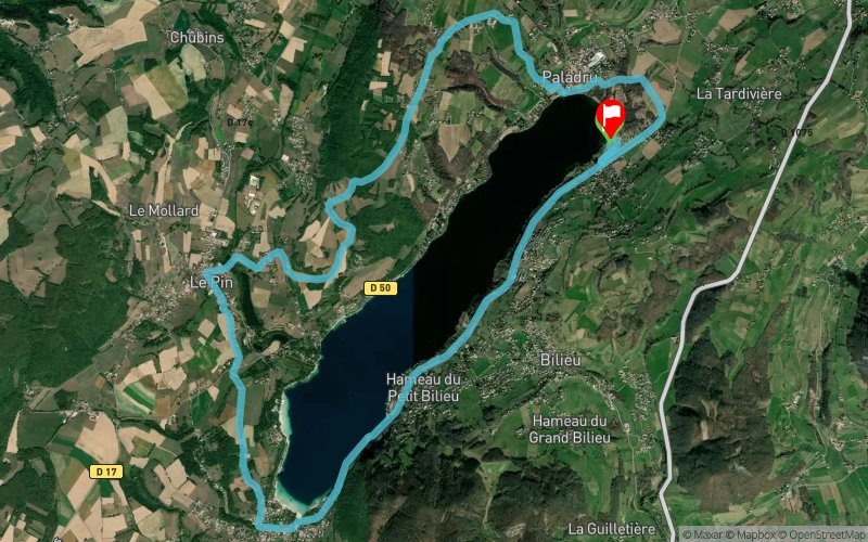
Triathlon du Lac de Paladru - Parcours Course à Pied
 17.7 km
290 m
290 m
17.7 km
290 m
290 m

21/09/2024
GPX
88
PDF
Profile
Share
3D
Favorites
Reviews
Like
Paladru (38) Paladru (38)
Effort kilometer
Longest ascent
Longest descent
20
160 m
190 m
Max. elevation
Min. elevation
Quality index
674 m
491 m
 1pt/15m
Start
Distance
0 km
Altitude
493 m
D+
0 m
D-
0 m
17.7 km
288 m
290 m
Finish
Distance
17.7 km
Altitude
491 m
D+
288 m
D-
290 m
Click on a point of interest to display it on the map
Reviews and times
Add a track
Triathlon du Lac de Paladru - Parcours Course à Pied

Track number : 118310
Link to track :
https://tracedetrail.fr/en/trace/118310
Log in to insert this track on your website
 Trace de Trail