
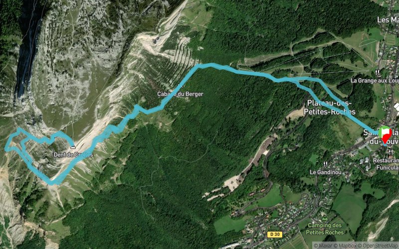
Cabane du Berger - Pas des Terreaux - Dent de Crolles
ROUTE TESTED BY THE AUTHOR
 10.7 km
1270 m
1270 m
10.7 km
1270 m
1270 m
GPX
18
PDF
Profile
Share
3D
Favorites
Reviews
Like
Saint-Hilaire (38) Saint-Hilaire (38)
Effort kilometer
Longest ascent
Longest descent
23
1230 m
1100 m
Max. elevation
Min. elevation
Quality index
2032 m
957 m
 1pt/7m
Start
Distance
0 km
Altitude
957 m
D+
0 m
D-
0 m
10.7 km
1270 m
1270 m
Finish
Distance
10.7 km
Altitude
957 m
D+
1270 m
D-
1270 m
Click on a point of interest to display it on the map
Reviews and times
Add a track
Cabane du Berger - Pas des Terreaux - Dent de Crolles

Track number : 116223
Link to track :
https://tracedetrail.fr/en/trace/116223
Log in to insert this track on your website
 Trace de Trail