
Epic Trail Run Azores 2020 - EPIC30
ITRA
 33.9 km
1820 m
1890 m
33.9 km
1820 m
1890 m

GPX
PDF
Profile
Share
3D
Favorites
Reviews
Like
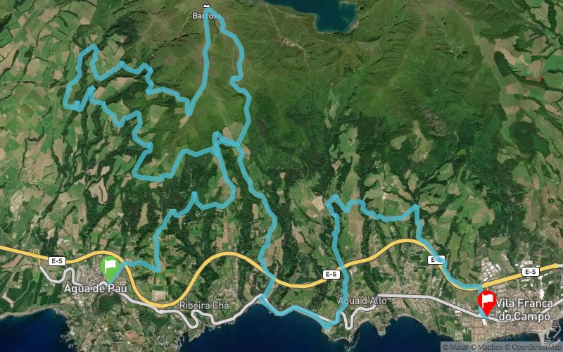
Água de Pau (PT) Vila Franca do Campo (PT)
Effort kilometer
Longest ascent
Longest descent
52
520 m
1420 m
Max. elevation
Min. elevation
Quality index
946 m
0 m
 1pt/14m
"Water Route" - Surrounded by the Atlantic Ocean, the Azores and the island of São Miguel offer athletes an atlantic route with passes through inhospitable peaks, volcanic lagoons and ancient trails. Dare to challenge this green hell, in an epic journey that honors the mountain and intact nature.

Start
Distance
0 km
Altitude
111 m
D+
0 m
D-
0 m
33.9 km
1819 m
1889 m
Finish
Distance
33.9 km
Altitude
43 m
D+
1819 m
D-
1889 m
Click on a point of interest to display it on the map
Reviews and times
Warning ! This track is only accessible on the day of the competition
Add a track
Epic Trail Run Azores 2020 - EPIC30

Track number : 109260
Link to track :
https://tracedetrail.fr/en/trace/109260
Log in to insert this track on your website
 Trace de Trail