
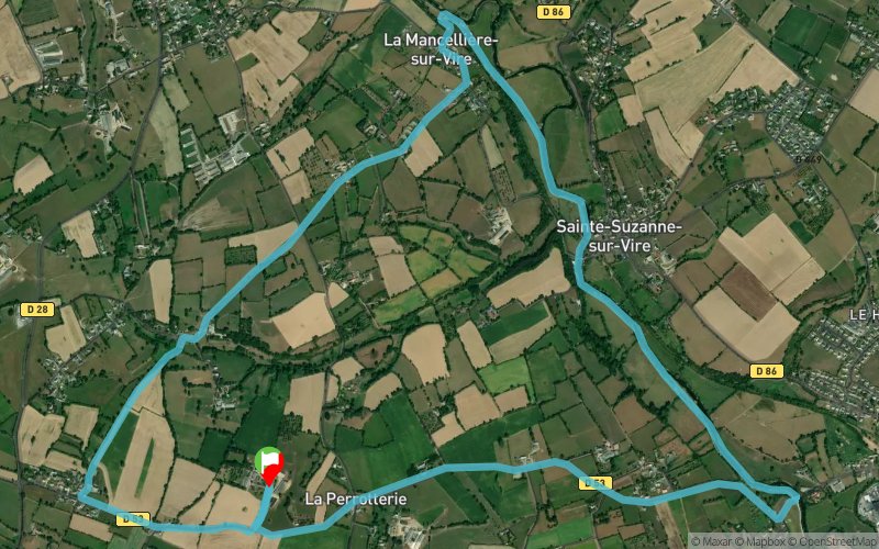
La Pédoyère - Ste-Suzanne-sur-Vire - La Mancellière-sur-Vire - Le Ronceur
 10.3 km
170 m
170 m
10.3 km
170 m
170 m
GPX
4
PDF
Profile
Share
3D
Favorites
Reviews
Like
Sainte-Suzanne-sur-Vire (50) Sainte-Suzanne-sur-Vire (50)
Effort kilometer
Longest ascent
Longest descent
12
100 m
80 m
Max. elevation
Min. elevation
Quality index
101 m
7 m
 1pt/86m
Start
Distance
0 km
Altitude
74 m
D+
0 m
D-
0 m
10.3 km
170 m
170 m
Finish
Distance
10.3 km
Altitude
74 m
D+
170 m
D-
170 m
Click on a point of interest to display it on the map
Reviews and times
Add a track
La Pédoyère - Ste-Suzanne-sur-Vire - La Mancellière-sur-Vire - Le Ronceur

Track number : 100523
Link to track :
https://tracedetrail.fr/en/trace/100523
Log in to insert this track on your website
 Trace de Trail