
Vuokatti Trail Challenge 2015 - 42km
ITRA
 42.7 km
1785 m
1850 m
42.7 km
1785 m
1850 m

Like
Favorites
Reviews
Share
GPX
30
PDF A4
PDF A0
Profile
Flyover
3D
Insert
Passages
Sotkamo, Maanselkä (FI) Sotkamo, Vuokatinhovi (FI)
Effort kilometer
Longest ascent
Longest descent
60
222 m
214 m
Max. elevation
Min. elevation
Quality index
388 m
122 m
 1pt/5m
42 km
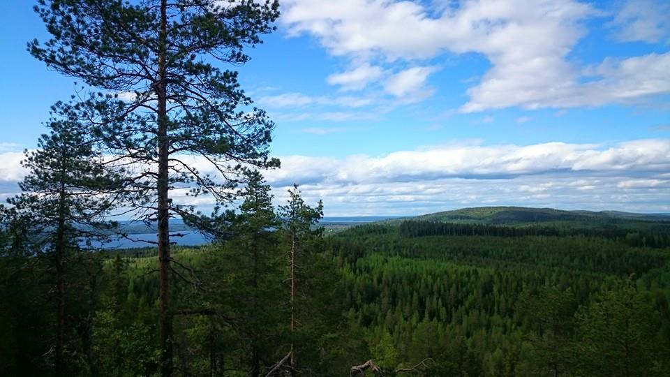
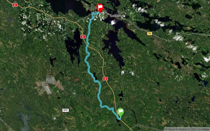
The start of the Vuokatti Trail Challenge 42 km competition is located at the Maanselän Etappi and the finish is at Vuokatinhovi. The track follows UKK-hiking path and offers great scenery and beautiful wilderness with old boreal forests. Shortly after the Maanselän Etappi there is a long uphill as the track goes over Lappavaara. After that the track is rather even and there are no big climbs before Teerivaara. The condition of the UKK-hiking path gets better in this part of the track and the duckboards and bridges are generally in good condition. The path is also good and easy to run. Wildlife can be seen throughout the Vuokatti Trail Challenge track, during the winter test runs the test team spotted wolf and bear tracks in this part of the track. After Teerivaara the competition route is same as the 23 km route (see 23 km route description).
En voir plus... En voir moins...

Maanselän Etappi
Distance
0 km
Altitude
198 m
D+
0 m
D-
0 m
42.7 km
1785 m
1850 m
Vuokatti, Vuokatinhovi
Distance
42.7 km
Altitude
136 m
D+
1785 m
D-
1850 m
Click on a point of interest to display it on the map
Reviews and times
Add a track
Vuokatti Trail Challenge 2015 - 42km

Track number : 8824
Link to track :
https://tracedetrail.fr/en/trace/8824
Log in to insert this track on your website
 Trace de Trail