
Vuokatti Trail Challenge 2015 - 110km
ITRA
 112 km
3526 m
3496 m
112 km
3526 m
3496 m

27/06/2015
Like
Favorites
Reviews
Share
GPX
42
PDF A4
PDF A0
Profile
Flyover
3D
Insert
Passages
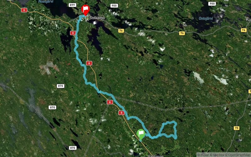
Valtimo, Puukari (FI) Sotkamo, Vuokatinhovi (FI)
Effort kilometer
Longest ascent
Longest descent
147
222 m
214 m
Max. elevation
Min. elevation
Quality index
388 m
68 m
 1pt/5m
75 km and 110 km
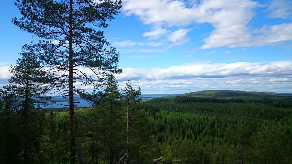
Both 75 km and 110 km competitions start in Valtimo near guesthouse Puukarin Pysäkki. The route is nearly same for both distances except that for 110 km route there is an extra loop of about 35 km (Halmejärvi-Peurajärvi-Murtovaara-Peurajärvi-Halmejärvi). The extra loop follows Talonpojan Taival –hiking trail but the path is very small and there is plenty of undergrowth. Terrain is mainly commercial forest with recently planted forests and logging places and is therefore quite slow and heavy to run. Nevertheless, the terrain is rather flat and approximately half of the extra loop is run on sand roads. Despite the mostly harsh route there are some nice places and beautiful scenery also in this part of the Vuokatti Trail Challenge. For example the Murtovaara house museum. After the Halmejärvi service point the route carries on towards Maanselän Etappi via UKK-hiking track. Duckboards and bridges are in poor shape and should be used with caution as they might break under runner’s weight. In this part of the track the runner can admire eq. Tavikoski rapid and magnificent several kilometers long esker on top of which the track runs. Sometimes spectacular viewpoints on top of ridges and forest hills surprise runners. Especially this part of the Vuokatti Trail Challenge radiates the spirit of wilderness and silence of forests where runner can enjoy clean and green nature. From Maanselän Etappi the route continues via 42 km route (see 42 km route description).
En voir plus... En voir moins...

Valtimo, Puukarin Pysäkki
Distance
0 km
Altitude
98 m
D+
0 m
D-
0 m
112 km
3526 m
3496 m
Vuokatti, Vuokatinhovi
Distance
112 km
Altitude
136 m
D+
3526 m
D-
3496 m
Click on a point of interest to display it on the map
Reviews and times
Add a track
Vuokatti Trail Challenge 2015 - 110km

Track number : 8822
Link to track :
https://tracedetrail.fr/en/trace/8822
Log in to insert this track on your website
 Trace de Trail