
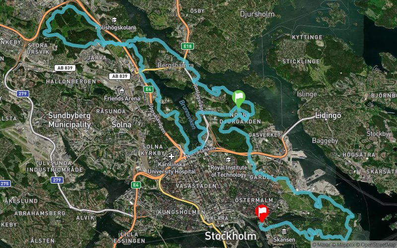
Ecotrail Stockholm 2018 - 45 km
ITRA
 44.2 km
890 m
890 m
44.2 km
890 m
890 m

Like
Favorites
Reviews
Share
GPX
18
PDF A4
PDF A0
Profile
Flyover
3D
Insert
Passages
Stocksund (SE) Stockholm (SE)
Effort kilometer
Longest ascent
Longest descent
53
100 m
90 m
Max. elevation
Min. elevation
Quality index
87 m
-1 m
 1pt/6m
Run through green forets, along the sea and feel the big city pulse, all during the same race. The 16th of June is the second edition of EcoTrail Stockholm

Start
Distance
0 km
Altitude
11 m
D+
0 m
D-
0 m
44.2 km
884 m
886 m
Finish
Distance
44.2 km
Altitude
8 m
D+
884 m
D-
886 m
Click on a point of interest to display it on the map
Reviews and times
Add a track
Ecotrail Stockholm 2018 - 45 km

Track number : 52400
Link to track :
https://tracedetrail.fr/en/trace/52400
Log in to insert this track on your website
 Trace de Trail