
Antelope Canyon 2018 - 100
ITRA
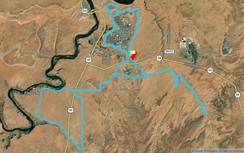
 159.5 km
1740 m
1740 m
159.5 km
1740 m
1740 m

Like
Favorites
Reviews
Share
GPX
6
PDF A4
PDF A0
Profile
Flyover
3D
Insert
Passages
Page (US) Inconnu (US)
Effort kilometer
Longest ascent
Longest descent
176
120 m
130 m
Max. elevation
Min. elevation
Quality index
1438 m
1233 m
 1pt/34m
On this course you will experience two of the most photographed land features in the country- Antelope Canyon and Horseshoe Bend of the Colorado River. After traversing the desert sand and slickrock to reach these unbelievable features, the run finishes out on smooth single track around the plateau that the city of Page, AZ is built upon, with jaw-dropping views of Lake Powell.
En voir plus... En voir moins...

Start
Distance
0 km
Altitude
1310 m
D+
0 m
D-
0 m
159.5 km
1740 m
1740 m
Finish
Distance
159.5 km
Altitude
1310 m
D+
1740 m
D-
1740 m
Click on a point of interest to display it on the map
Reviews and times
Add a track
Antelope Canyon 2018 - 100

Track number : 51946
Link to track :
https://tracedetrail.fr/en/trace/51946
Log in to insert this track on your website
 Trace de Trail