
White Rose Ultra 2018 - 100 Mile
ITRA
 165.4 km
4380 m
4430 m
165.4 km
4380 m
4430 m

Like
Favorites
Reviews
Share
GPX
4
PDF A4
PDF A0
Profile
Flyover
3D
Insert
Passages
Colne Valley Ward (GB) West Yorkshire (GB)
Effort kilometer
Longest ascent
Longest descent
209
280 m
230 m
Max. elevation
Min. elevation
Quality index
464 m
106 m
 1pt/28m
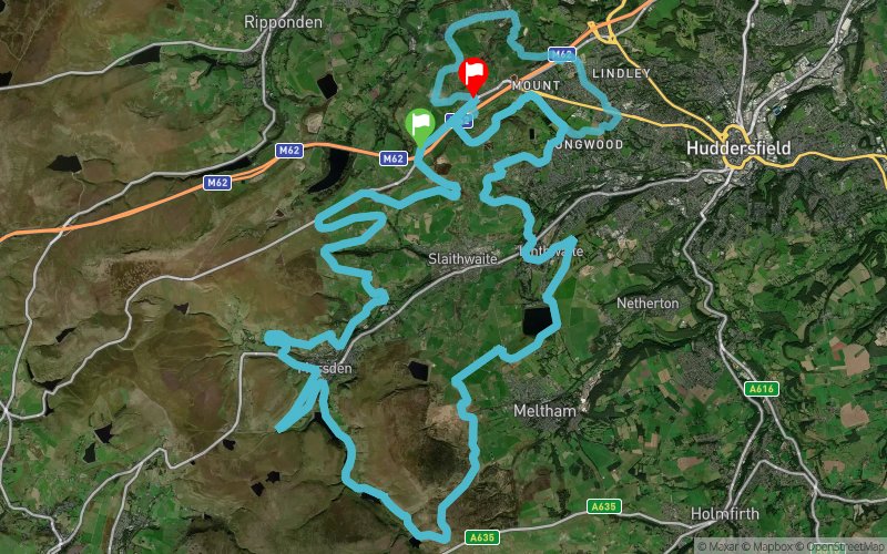
100 miles from start to finish, 3 laps of the standard WRU 30 + a 10 mile extension at the end. This will give you plenty of time to enjoy the area through the day, through the night & then back through the day.

Start
Distance
0 km
Altitude
325 m
D+
0 m
D-
0 m
165.4 km
4373 m
4422 m
Finish
Distance
165.4 km
Altitude
276 m
D+
4373 m
D-
4422 m
Click on a point of interest to display it on the map
Reviews and times
Add a track
White Rose Ultra 2018 - 100 Mile

Track number : 50407
Link to track :
https://tracedetrail.fr/en/trace/50407
Log in to insert this track on your website
 Trace de Trail