
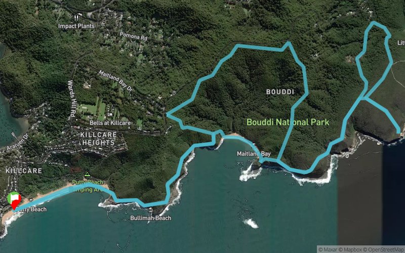
Bouddi Coastal Run 2017 - 21 km
ITRA
 21.2 km
710 m
700 m
21.2 km
710 m
700 m

Like
Favorites
Reviews
Share
GPX
5
PDF A4
PDF A0
Profile
Flyover
3D
Insert
Passages
Box Head (AU) Inconnu (AU)
Effort kilometer
Longest ascent
Longest descent
28
180 m
160 m
Max. elevation
Min. elevation
Quality index
163 m
-12 m
 1pt/4m
A spectacular 21km trail run through the Bouddi National Park. The course takes in the sites of Putty Beach, Gerrin Point, Maitland Bay, Bouddi and Bombi Point. With cliff top views of the unique Marine Park and natural beauty of this area.

Start
Distance
0 km
Altitude
7 m
D+
0 m
D-
0 m
21.2 km
710 m
700 m
Finish
Distance
21.2 km
Altitude
7 m
D+
710 m
D-
700 m
Click on a point of interest to display it on the map
Reviews and times
Add a track
Bouddi Coastal Run 2017 - 21 km

Track number : 48417
Link to track :
https://tracedetrail.fr/en/trace/48417
Log in to insert this track on your website
 Trace de Trail