
Gran Trail Courmayeur 2018 - GTC 30 km
ITRA
 28 km
2090 m
2080 m
28 km
2090 m
2080 m

Like
Favorites
Reviews
Share
GPX
4
PDF A4
PDF A0
Profile
Flyover
3D
Insert
Passages
Courmayeur (IT) Inconnu (IT)
Effort kilometer
Longest ascent
Longest descent
48
1100 m
620 m
Max. elevation
Min. elevation
Quality index
2524 m
1170 m
 1pt/19m
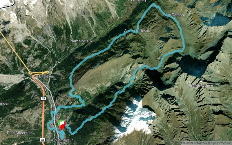
Il percorso si snoda lungo i sentieri del territorio di Courmayeur, per una lunghezza totale di 30 km circa ed un dislivello positivo di 2000 mt, sviluppandosi prevalentemente lungo la Val Ferret.

Start
Distance
0 km
Altitude
1210 m
D+
0 m
D-
0 m
28 km
2090 m
2080 m
Finish
Distance
28 km
Altitude
1210 m
D+
2090 m
D-
2080 m
Click on a point of interest to display it on the map
Reviews and times
Add a track
Gran Trail Courmayeur 2018 - GTC 30 km

Track number : 48055
Link to track :
https://tracedetrail.fr/en/trace/48055
Log in to insert this track on your website
 Trace de Trail