
Germes : X-Cross 2017 - L
ITRA
 23.1 km
170 m
170 m
23.1 km
170 m
170 m

Like
Favorites
Reviews
Share
GPX
22
PDF A4
PDF A0
Profile
Flyover
3D
Insert
Passages
???????? (RU) Inconnu (RU)
Effort kilometer
Longest ascent
Longest descent
24
60 m
40 m
Max. elevation
Min. elevation
Quality index
171 m
121 m
 1pt/10m
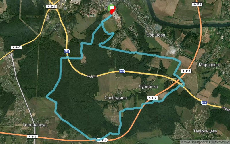
"L" - Distance, which offers participants the verification of both high-speed and technical skills. The length of the track is 23.5 km. 90% laid along forest and field trails, with natural obstacles of fallen trees, dense grass, bushes, ditches, etc. Requires special attention and care from athletes. In the middle of the distance there is a refreshment point. Cut off time 3 hours.
En voir plus... En voir moins...

Start
Distance
0 km
Altitude
121 m
D+
0 m
D-
0 m
23.1 km
170 m
170 m
Finish
Distance
23.1 km
Altitude
121 m
D+
170 m
D-
170 m
Click on a point of interest to display it on the map
Reviews and times
Add a track
Germes : X-Cross 2017 - L

Track number : 45181
Link to track :
https://tracedetrail.fr/en/trace/45181
Log in to insert this track on your website
 Trace de Trail