
Sky Grancanaria 2018 - Ultrasky AM72
ITRA
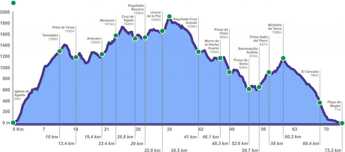
 72.8 km
4580 m
4630 m
72.8 km
4580 m
4630 m

Like
Favorites
Reviews
Share
GPX
25
PDF A4
PDF A0
Profile
Flyover
3D
Insert
Passages
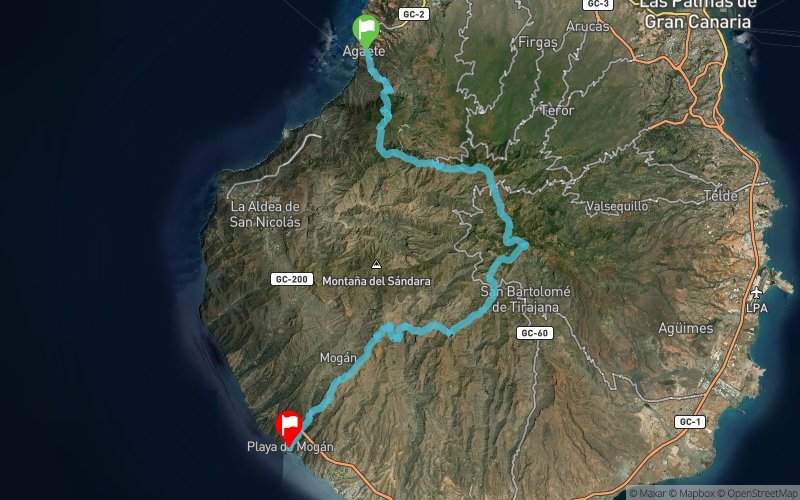
Palmeral, El (Agaete) (Urbanizacion) (ES) Mogan, De (Playa) (ES)
Effort kilometer
Longest ascent
Longest descent
118
1510 m
730 m
Max. elevation
Min. elevation
Quality index
1937 m
10 m
 1pt/12m
La utraltrail de 72 Km partirá desde el pueblo de Agaete, en el noroeste de la isla de Gran Canaria,para atravesar los municipios de Agaete, Artenara, Tejeda, Vega de San Mateo, San Bartolomé de Tirajana y finaliza en la Playa de Mogán.

Agaete
Distance
0 km
Altitude
59 m
D+
0 m
D-
0 m
72.8 km
4577 m
4621 m
Playa de Mogán
Distance
72.8 km
Altitude
10 m
D+
4577 m
D-
4621 m
Click on a point of interest to display it on the map
Reviews and times
Add a track
Sky Grancanaria 2018 - Ultrasky AM72

Track number : 42295
Link to track :
https://tracedetrail.fr/en/trace/42295
Log in to insert this track on your website
 Trace de Trail