
Tushars 2017 - 100K
ITRA
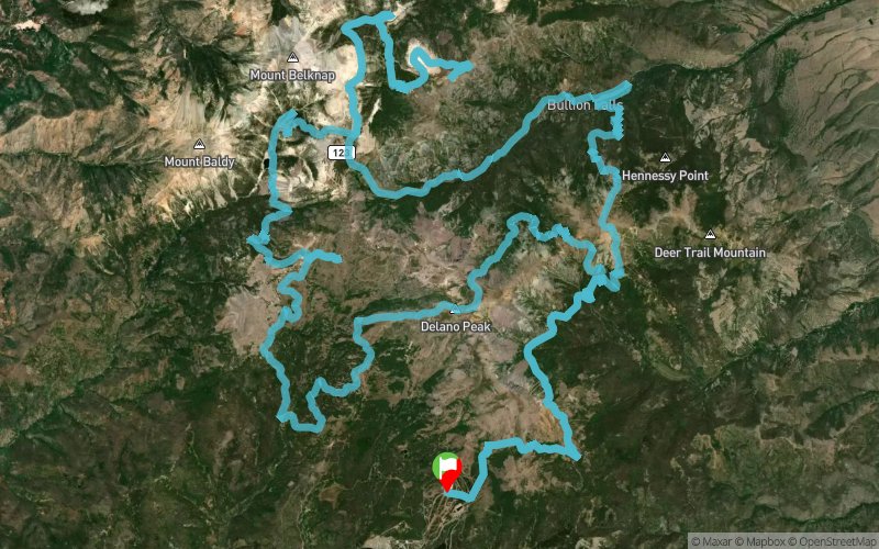
 97.8 km
5290 m
5300 m
97.8 km
5290 m
5300 m

Like
Favorites
Reviews
Share
GPX
26
PDF A4
PDF A0
Profile
Flyover
3D
Insert
Passages
Beaver (US) Inconnu (US)
Effort kilometer
Longest ascent
Longest descent
150
1000 m
1190 m
Max. elevation
Min. elevation
Quality index
3707 m
2392 m
 1pt/31m
The Tushar 100K is a hidden treasure of 12,000 ft peaks not far from Bryce Canyon National Park. This is one of the most challenging courses in the “Grand Circle Trail Series”. Runners will summit peaks and run ridgelines among a thriving mountain goat herd then drop down singletrack into vast, glaciated valleys spattered with abandoned mining ruins from the wild west. The race starts and finishes at Eagle Point Ski Resort at an elevation of over 10,000ft.
En voir plus... En voir moins...

Start
Distance
0 km
Altitude
3151 m
D+
0 m
D-
0 m
97.8 km
5290 m
5300 m
Finish
Distance
97.8 km
Altitude
3151 m
D+
5290 m
D-
5300 m
Click on a point of interest to display it on the map
Reviews and times
Add a track
Tushars 2017 - 100K

Track number : 34877
Link to track :
https://tracedetrail.fr/en/trace/34877
Log in to insert this track on your website
 Trace de Trail