
Trail & Walk 2 Heaven
ITRA
 17.69 km
414 m
1025 m
17.69 km
414 m
1025 m


05/09/2026
Like
1 Favorites
Reviews
Share
GPX
4
PDF A4
PDF A0
Profile
Flyover
3D
Insert
Passages
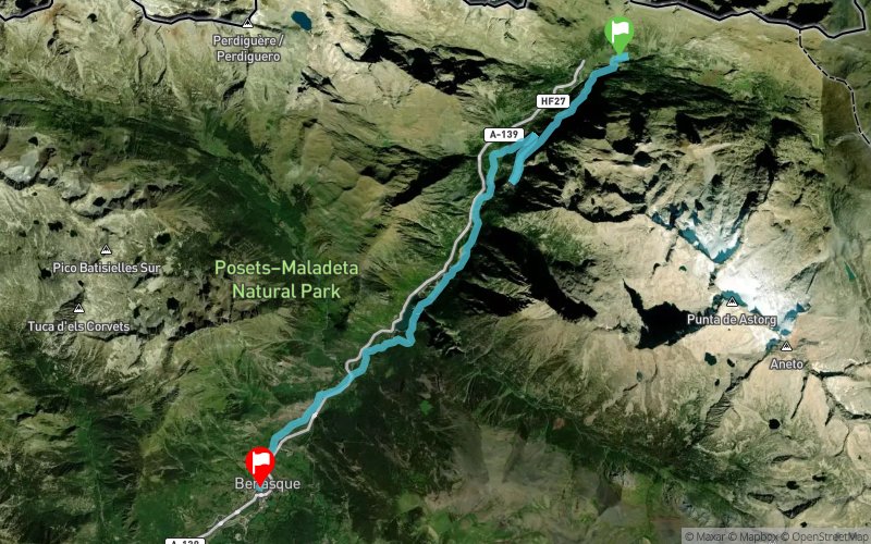
Llanos del Hospital (ES) Benasque (ES)
Effort kilometer
Longest ascent
Longest descent
21
110 m
300 m
Max. elevation
Min. elevation
Quality index
1844 m
1134 m
 1pt/7m
WALK OR RUN THROUGH HISTORY
17 km following a historic trail that connects the Benasque Valley with the Bagneres-de-Luchon Valley, offering a perfect introduction to trail running. Participants can choose to complete it either as a hike or a run.
Starting at the foot of Mount Aneto, at the Nordic ski resort of Los Llanos del Hospital, the route spans, 17,2km y 320m of elevation gain leading to the finish line in the town of Benasque.
En voir plus... En voir moins...

Départ
Distance
0 km
Altitude
1746 m
D+
0 m
D-
0 m
17.7 km
414 m
1025 m
Arrivée
Distance
17.7 km
Altitude
1135 m
D+
414 m
D-
1025 m
Village
Click on a point of interest to display it on the map
Reviews and times
Add a track
Trail 2 Heaven - Trail & Walk 2 Heaven

Track number : 329530
Link to track :
https://tracedetrail.fr/en/trace/329530
Log in to insert this track on your website
 Trace de Trail