
Madruk Trail 27Km
ITRA
 27.78 km
1804 m
1804 m
27.78 km
1804 m
1804 m

Like
2 Favorites
Reviews
Share
GPX
85
PDF A4
PDF A0
Profile
Flyover
3D
Insert
Passages
via de Nadai, 4, Vittorio Veneto (IT) via de Nadai, 4, Vittorio Veneto (IT)
Effort kilometer
Longest ascent
Longest descent
45
1490 m
1290 m
Max. elevation
Min. elevation
Quality index
1564 m
124 m
 1pt/6m
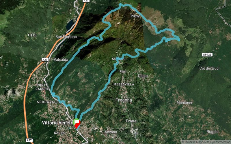
The Madruk Trail is a race of 27 km length and approximately 1.800mD+, in Vittorio Veneto (Italy). Madruk Trail provides a challenging route in Vittorio Veneto forests, during the beautiful spring colors of Venetian Pre-Alps. This is a medium technical trail (due to rocky areas). The trail surface varies from narrow forest trail to wide fire road, gravel, dirt, and paved roads. Several up and downhills are along the course. Participating to Madruk Trail 27 Km you earn 2 points ITRA . There is also a shorter version called Madruk Trail Short which is a race of 16 Km length and total ascent about 930 mt - 1 point ITRA. Madruk Trail is "20k M Qualifier" for UTMB
En voir plus... En voir moins...

Start
Distance
0 km
Altitude
125 m
D+
0 m
D-
0 m
27.8 km
1804 m
1804 m
Finish
Distance
27.8 km
Altitude
125 m
D+
1804 m
D-
1804 m
Click on a point of interest to display it on the map
Reviews and times
Add a track
Madruk Trail Madruk Trail 27Km

Track number : 329326
Link to track :
https://tracedetrail.fr/en/trace/329326
Log in to insert this track on your website
 Trace de Trail