
PIC DU DIABLE
ITRA
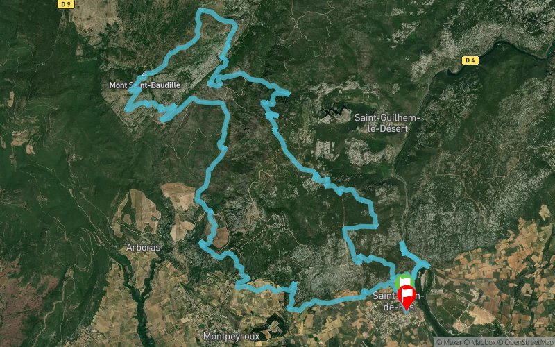
 38.46 km
1407 m
1412 m
38.46 km
1407 m
1412 m

29/03/2026
Like
Favorites
Reviews
Share
GPX
PDF A4
PDF A0
Profile
Flyover
3D
Insert
Passages
Saint-Jean-de-Fos (34) Saint-Jean-de-Fos (34)
Effort kilometer
Longest ascent
Longest descent
52
560 m
440 m
Max. elevation
Min. elevation
Quality index
840 m
56 m
 1pt/22m
Track created by Foyer Rural St Jean de Fos - Trail de Clamouse
le 2025/11/06
le 2025/11/06

PIC DU DIABLE
Distance
0 km
Altitude
98 m
D+
0 m
D-
0 m
08:00
38.5 km
1407 m
1412 m
Finish
Distance
38.5 km
Altitude
93 m
D+
1407 m
D-
1412 m
Click on a point of interest to display it on the map
Reviews and times
Warning ! This track is only accessible on the day of the competition
Add a track
TRAIL DE CLAMOUSE PIC DU DIABLE

Track number : 319625
Link to track :
https://tracedetrail.fr/en/trace/319625
Log in to insert this track on your website
 Trace de Trail