
 68.78 km
2450 m
2450 m
68.78 km
2450 m
2450 m
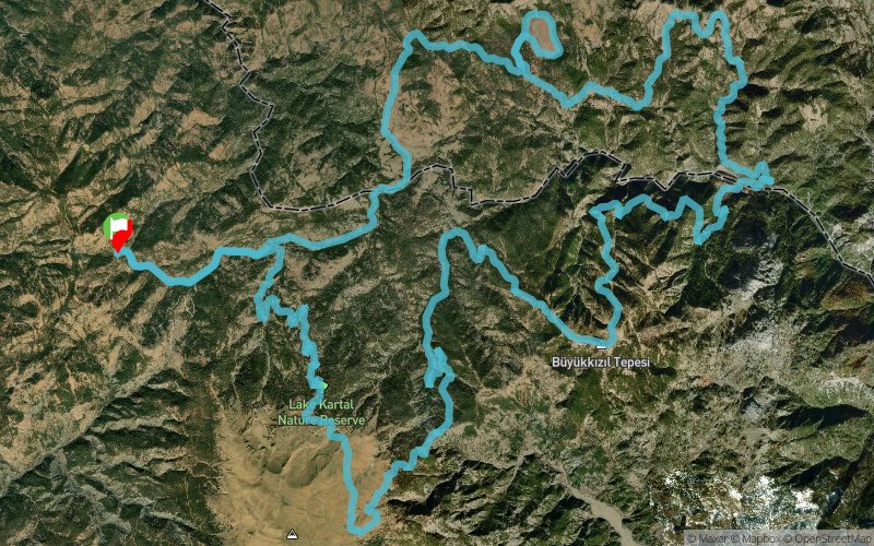
 1pt/20m
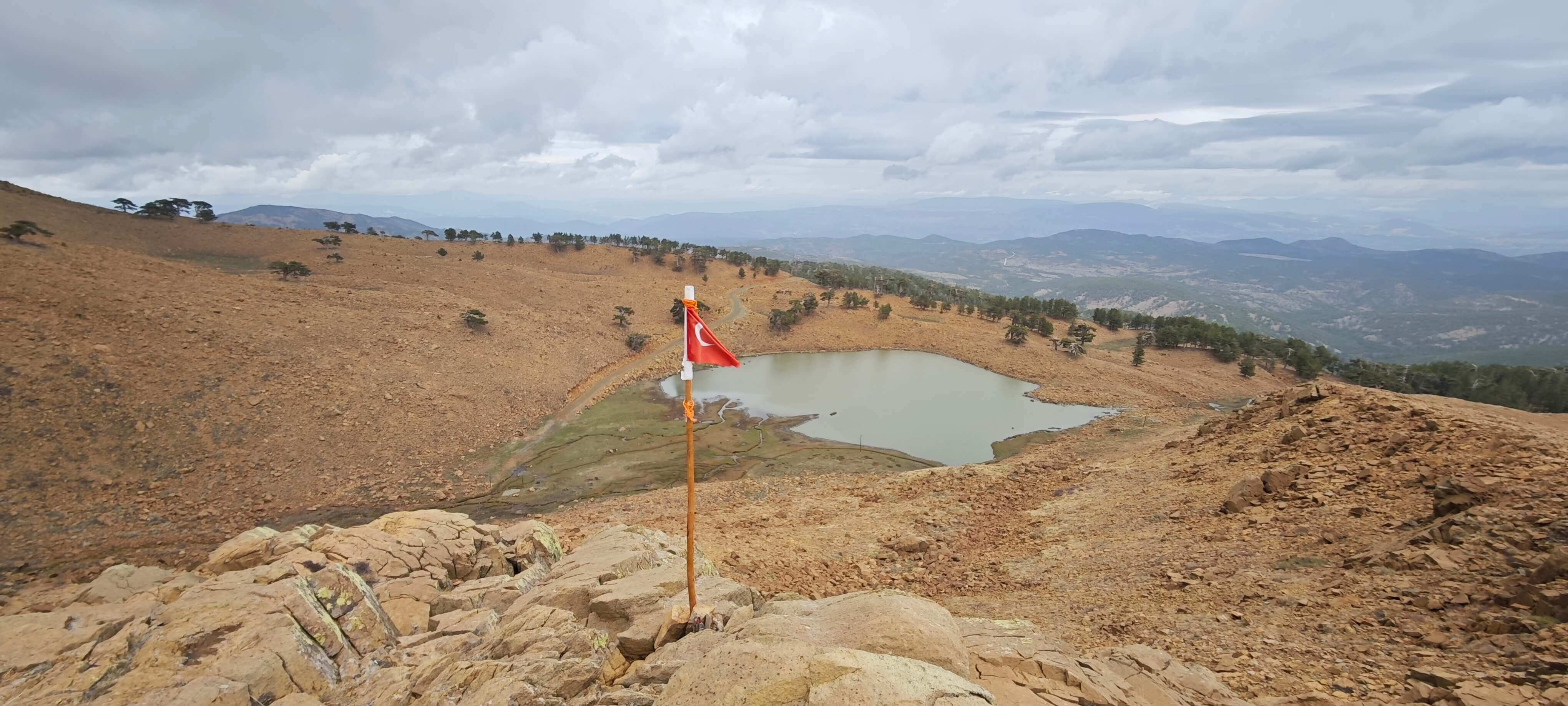
The Sandras Ultra Trail 70K is the flagship course of the event, tracing a full loop around the majestic Sandras Mountain in the Denizli – Beyagac region of southwestern Turkey. Starting from Topuklu Plateau, runners ascend through the Kartal Lake Nature Reserve, an area of exceptional natural beauty, home to ancient cedar forests, mountain springs, and rare alpine flora. Covering 68.9 kilometers with a total elevation gain and loss of 2,856 meters, this challenging route offers a true test of endurance, focus, and self-reliance. The trail winds through high plateaus above 2,000 meters, rugged ridgelines, pine and cedar forests, and open mountain paths with panoramic views that extend across the Taurus range. This course demands strength and strategy — steep climbs, technical descents, and long runnable forest sections alternate to create a perfectly balanced mountain ultra. Aid stations are placed at strategic points to provide support while preserving the raw and natural spirit of the terrain. The Sandras Ultra Trail 70K is more than a competition; it is an immersion into the wild soul of Anatolia and the Yörük mountain heritage. Each participant is invited to discover the rhythm of nature, the silence of the peaks, and the resilience that comes from running among the elements. Organized with respect for sustainability and the preservation of local culture, the Sandras Ultra Trail 70K embodies the harmony between sport, nature, and tradition — an unforgettable experience for those who seek not only to finish, but to truly feel the mountain.


 Trace de Trail