
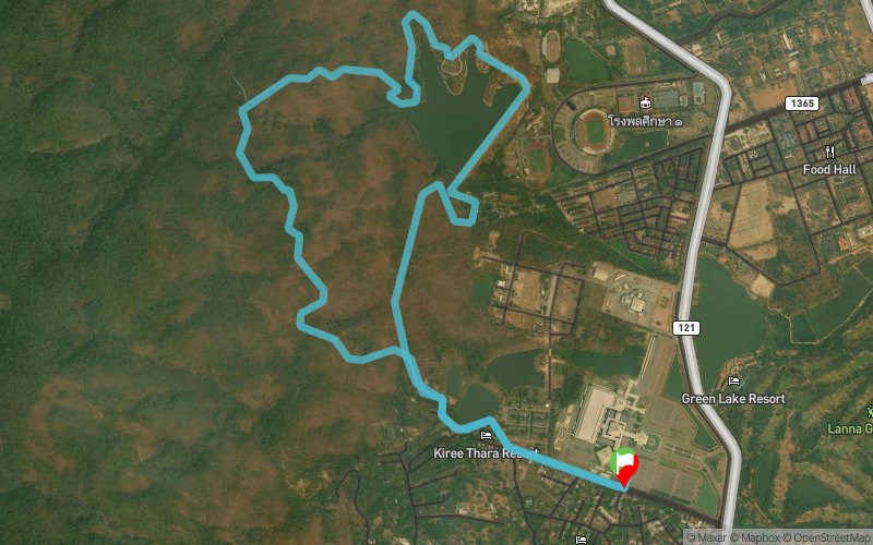
PST10
 9.85 km
419 m
419 m
9.85 km
419 m
419 m

16/11/2025
Like
Favorites
Reviews
Share
GPX
3
PDF A4
PDF A0
Profile
Flyover
3D
Insert
Passages
Muang Chiang Mai (TH) Muang Chiang Mai (TH)
Effort kilometer
Longest ascent
Longest descent
14
230 m
270 m
Max. elevation
Min. elevation
Quality index
573 m
331 m
 1pt/7m
An inviting introduction to trail running with a short climb to a small waterfall and winding singletrack sections. Ideal for beginners or anyone seeking a light adventure close to nature.

Start
Distance
0 km
Altitude
334 m
D+
0 m
D-
0 m
9.9 km
419 m
419 m
Finish
Distance
9.9 km
Altitude
334 m
D+
419 m
D-
419 m
Click on a point of interest to display it on the map
Reviews and times
Add a track
Pocari Sweat Trail PST10

Track number : 312050
Link to track :
https://tracedetrail.fr/en/trace/312050
Log in to insert this track on your website
 Trace de Trail