
PST50
ITRA
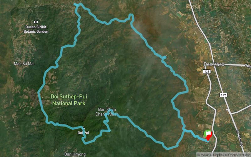
 48.19 km
2291 m
2291 m
48.19 km
2291 m
2291 m


Like
Favorites
Reviews
Share
GPX
13
PDF A4
PDF A0
Profile
Flyover
3D
Insert
Passages
Muang Chiang Mai (TH) Muang Chiang Mai (TH)
Effort kilometer
Longest ascent
Longest descent
71
1510 m
1330 m
Max. elevation
Min. elevation
Quality index
1677 m
332 m
 1pt/7m
A vibrant loop course featuring a long, scenic climb to start the day before joining the 100K route on the second half. Expect diverse terrain, cultural trails, and warm support from every aid station along the way.

Start
Distance
0 km
Altitude
332 m
D+
0 m
D-
0 m
48.2 km
2291 m
2291 m
Finish
Distance
48.2 km
Altitude
332 m
D+
2291 m
D-
2291 m
Click on a point of interest to display it on the map
Reviews and times
Add a track
Pocari Sweat Trail PST50

Track number : 311473
Link to track :
https://tracedetrail.fr/en/trace/311473
Log in to insert this track on your website
 Trace de Trail